Kelly Rose
Editor
Kelly Rose
Editor
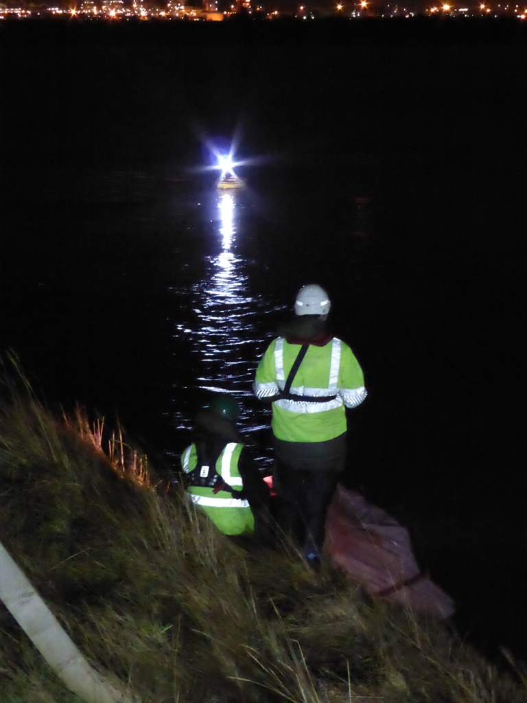
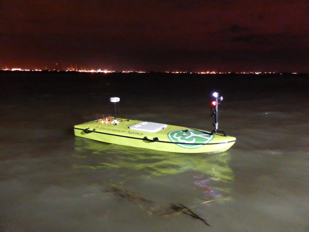
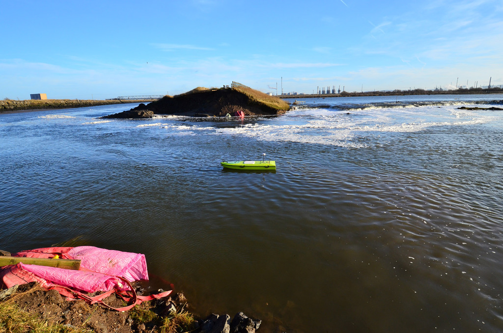
A remote control boat equipped with a SonTek M9 Acoustic Doppler Profiler (ADP) has been employed with HydroSurveyor software from Xylem Analytics to create a 3-dimensional map of a damaged (and still submerged) flood barrier, following serious damage that took place at Seal Sands near Billingham during last December’s storms.
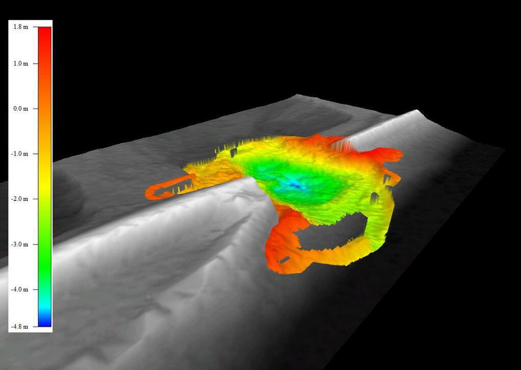
Data from the survey enabled the Environment Agency to act swiftly and effectively to repair the damage and thereby protect local industry and residents.
The M9 ADP on-board the remote controlled ‘ARC-Boat’ is a 5-beam depth sounding and velocity profiling device that scans the bed as the boat is guided across the water’s surface. Recorded data are analysed in real-time by the SonTek HydroSurveyor software to produce accurate depth and velocity measurements in addition to 3-D maps of the water body.
The Agency’s Chris Train says: "The HydroSurveyor software created a superb map of the damage and demonstrated that the hole was significantly deeper than we had anticipated, so this data was essential in helping us to plan the remediation work.
"The main advantages of the ARC-Boat/HydroSurveyor system are the speed with which a survey is undertaken, the quality of the data, and improved safety because it is not necessary for staff to work on the water.”
2 Focal Point
Lacerta Court
Letchworth
SG6 1FJ
UNITED KINGDOM
01462 673581